
| Added | Thu, 06/10/2016 |
| Sources | |
| Феномены | |
| Version type |
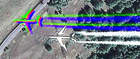
To receive color photographs should be done for two shots. One black and white, high resolution, and the second lower-resolution, but in color. Further the obtained color image is stretched and applied to the black-and-white as a texture. Such action is necessary because due to the different refraction of light rays of different spectrum when passing through the atmosphere from the color image of high resolution from space do not work. These features form the image are almost not noticeable on stationary objects, but clearly distinguishable when the shot fall fast moving objects such as planes or cars.
Since the advent of widely available maps taken from the satellite, many paranormal researchers and other curious people began to find various items, which are often considered evidence of something anomalous.
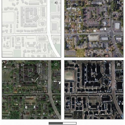
Let us consider first briefly the principle of the formation of satellite maps.
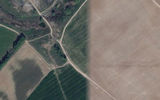
To create a map it is necessary to obtain many images from the satellite. They are obtained immediately, at the same time, but systematically, during the satellite's flight around the Earth. The satellite should not do one pass, because it revolves around the Earth, which, in turn, rotates around its axis and its trajectory has the form of a sine wave, which at each cycle slightly shifted relative to the surface of the planet. The selection of images is also influenced by factors such as weather conditions (clouds must not cover the desired area), the shooting time (the night shots are not suitable for the formation of map), etc. Thus, adjacent fragments of a map can be done with the time difference, sometimes reaching several months, and even years. For this reason, the map may consist of images of different light and even different time of year.
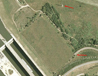
Sometimes in the splice of the pictures are amusing artifacts such as aircraft, without a shadow, a shadow without a plane, or a combination of different parts of the same object in different periods of its construction.
Another problem of forming the images on the map is the distortion of the angles, because shooting different areas made from different points.
To receive color photographs should be done for two shots. One black and white, high resolution, and the second lower-resolution, but in color. Further the obtained color image is stretched and applied to the black-and-white as a texture. Such action is necessary because due to the different refraction of light rays of different spectrum when passing through the atmosphere from the color image of high resolution from space do not work. These features form the image are almost not noticeable on stationary objects, but clearly distinguishable when the shot fall fast moving objects such as planes or cars.
Many of the above problems try to avoid newer versions of satellite maps.
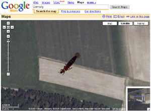
In the course of processing satellite images, for example when scanning images, may also be formed of various artifacts caused in particular by contact between the scanner glass and the film of various items (insects, dust and the like).
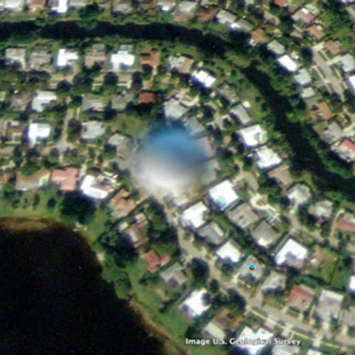
In addition to the technical characteristics of the formation cards that can be taken for a picture of something unexplained, there are also defects associated with the physical characteristics of the machinery used. As an example of artifacts of this type can cause glare created by the sun reflected from various objects (a direct reflection of sunlight overloads the CCD matrix camera).
Many artifacts created artificially for the purpose of preservation of state secrets and privacy of those who do not wish to be "seen from above".
To hide areas on satellite images are used in several ways:
- The pixelation of the image.
- Image blurring.
- Closing an image in one colour flap (the old way, also to similar effect the bonding defects of the image, etc.).
- Replacement parts cards that you want to hide the images with lower resolution (either this site is not updated and remains as it was when the first shot) or older (by date of survey).
- Disguise.
- The combination of the above methods.
In addition to the actual artifacts in different anomalies can be accepted quite normal, since looking at them at unusual angles. This applies not only to satellite maps, but also for additional services like Google Street View.
When forming images of streets used panoramic shot, which also uses the principles of bonding a single image from multiple sequential shots.
For those photos as actual defects and errors, as for any other photo – flare, flare, shooting random objects, etc.
In addition to random circumstances and technical artifacts, there are many specially made by the developers of secrets "Easter eggs" (the hunters website "Easter eggs").
While studying satellite imagery, you can really find something still unknown. As a result of their study that was made many true discoveries as they have allowed many people to see the world from an unusual angle.
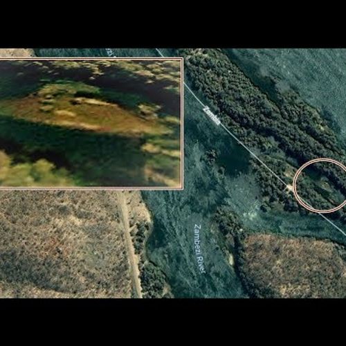
One of the first archaeological discoveries made in Google Earth Italian Luca Mori, took place in 2005. He launched this program just to see the surroundings of his native Parma. Suddenly he saw a strange oval-shaped object in the fields near the city. Luke first took him for a computer "glitch", but still informed the specialists who organized the expedition. After the beginning of excavations in this place they found the remains of a Roman Villa, built before our era.
Many of the artifacts found on satellite images, is not unusual. However, sometimes it is necessary to take a closer look to such portions of the cards, because they can carry more than the result of an error in the process of complex processing of satellite images.
Translated by «Yandex.Translator»


Google Maps. Coordinates: 55°34'59.7"N 37°45'31.2"E
Translated by «Yandex.Translator»

The metal roof of the house. Coordinates: 51.724315, 36.185721
Translated by «Yandex.Translator»

The glare in the picture North Acomita Village, New Mexico.
Translated by «Yandex.Translator»

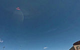
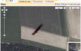
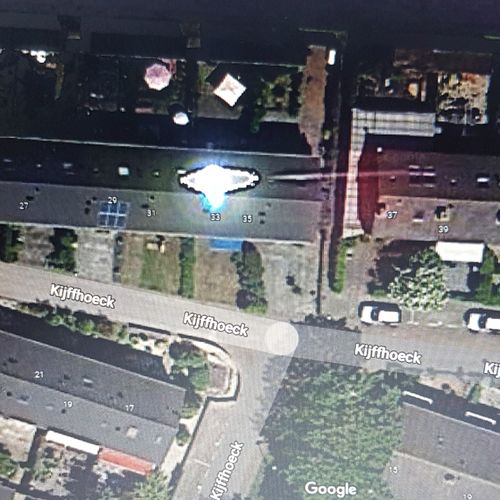
The plane with the blue "shadow"
The effect is obtained due to the displacement of the object between shot black-and-white frame and color.
Date of photo: 29.03.2015
Map type: Google Maps
Coordinates: 55°24'30.8"N 37°56'17.9"E
Translated by «Yandex.Translator»
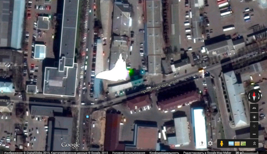
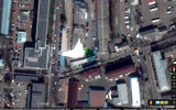
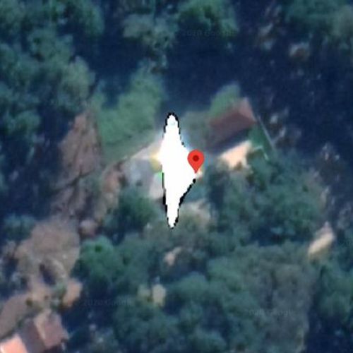
White glare over the house
The glare created by the sun reflection from metal, the shiny roof of a house (the direct reflection of sunlight overloads the CCD matrix camera).
Date of photo: 29.03.2015
Map type: Google Maps
Coordinates: 50°26'56.0"N 30°24'40.6"E
Translated by «Yandex.Translator»

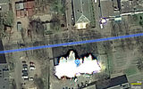
Blik over the house
The glare created by the sun reflection from metal, the shiny roof of a house (the direct reflection of sunlight overloads the CCD matrix camera).
Date of photo: 29.03.2015
Card type: Yandex.Card
Coordinates: 50.508268,30.452588
Translated by «Yandex.Translator»
Related facts

Related news
American experts have learned to fake satellite images
Log in or register to post comments