| Added | Thu, 05/10/2017 |
| Источники | |
| Дата публикации | Thu, 05/10/2017
|
| Версии |
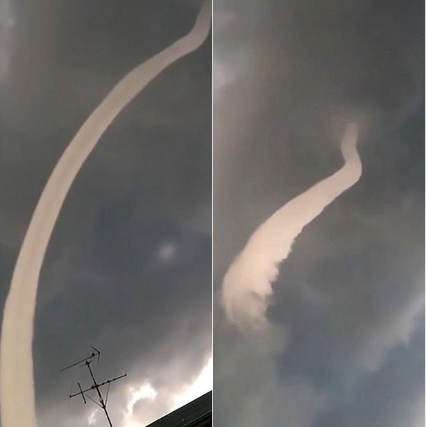
In the skies over Japan were observed a rare atmospheric phenomenon – cloud-a funnel. These clouds sometimes represent the initial stage of the origin of tornadoes, though usually dissipate into the atmosphere, without bringing any harm. The cloud photographed above the city of Niigata in the Central part of Honshu island. Witnesses described the spectacle is seen as "fascinating", reports the Daily Mail.
On record it is visible, like a pale cloud in the form of a rotating pipe rises up against the dark storm clouds. Then it gradually begins to dissolve, starting at the lower end, and a few seconds disappears completely in the air.
One of the witnesses posted the video on weather website Weathernews, where it in a matter of days it was viewed more than 60 thousand times and received more than 90 thousand likes. Cloud-the funnel can turn into a tornado if their bottom edge touches the ground or water. Usually they are formed when a rotating air stream captures the water droplets, forming of them a sort of tube.
Translated by «Yandex.Translator»
Новости со схожими версиями
Log in or register to post comments


